October 25, 2025
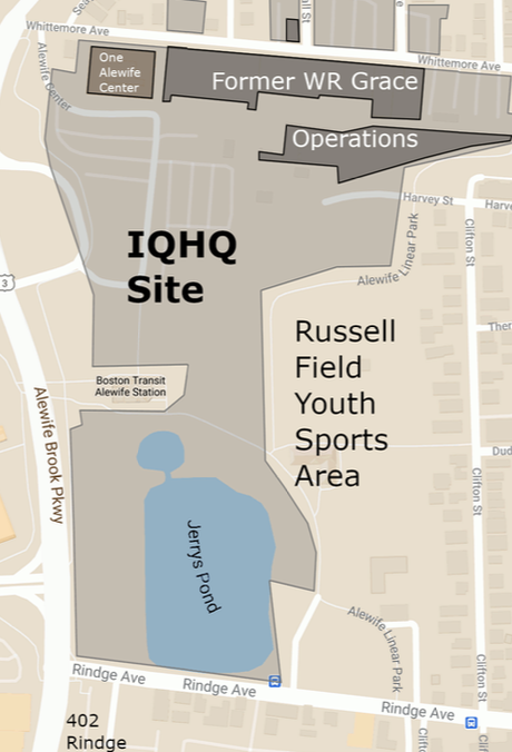
Beginning summer 2025, neighbors’ growing concerns about safety on the paths criss-crossing the rectangle of land bounded by Rindge Ave., Clifton St., Whittemore Ave. and Alewife Brook Parkway, made improving Path Safety an ASG priority. Here are three maps to help understand the issue:
Map of the rectangle:
Map showing paths nicknamed Red Riding Hood’s Curve and The Scary Path

Map of new IQHQ routes (in green) – concrete sidewalks for pedestrians, service road available to bikes, and multi-use asphalt paths:
